One question I always ask my students during our Water Wonders class is; “Where does our water come from?” Some students initially respond with; “The faucet!” or, “A lake!” but when I probe them further they answer with, “The Colorado River.” And, for the majority of our students, this is true. But, my favorite response is their wide eyes when I tell them where High Trails water comes from and that we can hike there for class.
 Not many people, 5th and 6th grade students especially, get to see the exact source of their drinkable water. Most of us are unaware of the incredible journey water takes in order to flow to our showerheads or our faucets.
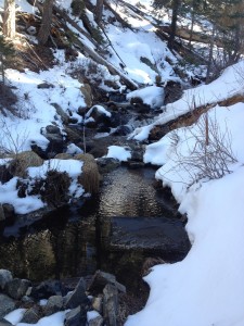
At High Trails, our water is pumped directly from a well at the headwaters of the Santa Ana River. The hike takes students away from a forest road to a gorgeous mountain overlook that drops to a narrow path lined with Live Oaks, single leaf Pinion pines, and Incense Cedar trees.
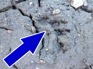
My first time on this trail, my students witnessed bobcat tracks in the snow and black bear tracks in a patch of mud – a sight that is usually masked by the footprints of students.
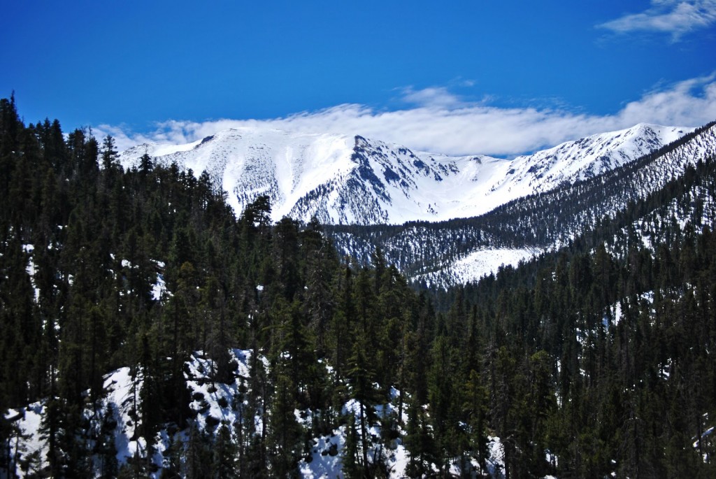
 From there, we plunged deeper until we witnessed Old Grayback, formally known as Mt. San Gorgonio. At just shy of 11,500 feet tall, San G is the roof of Southern California. At trails end, we reach the San Gorgonio Wilderness boundary and a small creek that starts it all. The hike is long and arduous, but leaves students with a strong feeling of accomplishment. They made it!
Then, the inevitable question is asked, “Kate, how was this river formed?”
I tell them that it takes many smaller tributaries to form a river of this magnitude. Through our activity “Sum of the Parts” where the students make their own town alongside a river, they understand how pollution travels and accumulates downstream. Because they can see part of the Santa Ana River’s beginning, they start to appreciate how lucky we are to drink water from such an unadulterated source.
Twenty miles from the headwaters, the Santa Ana River becomes unrecognizable because it has been channeled and diverted from dams through concrete canals to provide water for parts of Los Angeles, Orange, and San Bernardino counties.
I firmly believe it is important to know how our drinking water gets to our faucets and how we can protect this finite resource. It is hard for a student to wrap his or her head around the 96 miles of the Santa Ana River and feel a strong bond; especially when most of the river doesn’t look like a river at all. But, if a student is in awe of the surrounding mountains, or entranced by the way the water rushes and falls over boulders, attachment becomes a real possibility.
 As a middle school student in Illinois, I took a steamboat ride down a section of the Mississippi River as a part of our Mark Twain literature unit. Before this, the mighty Mississip’ (as it’s fondly called) was no more than a squiggly line on a map to me. Twain believed that the face of a river was like a book, but one that told a new story every day. I like to think that if my students can see how wild and free the upper Santa Ana is, that they will be more motivated to rewrite its story and protect it for years to come.
At High Trails Outdoor Science School, we literally force our instructors to write about elementary outdoor education, teaching outside, learning outside, our dirty classroom (the forest…gosh), environmental science, outdoor science, and all other tree hugging student and kid loving things that keep us engaged, passionate, driven, loving our job, digging our life, and spreading the word to anyone whose attention we can hold for long enough to actually make it through reading this entire sentence. Whew…. www.dirtyclassroom.com
Comments are closed.