Right foot, kick. Left foot, kick. Reposition ice axe. Repeat.
You hear the wind come roaring over the notch in the ridge and brace yourself as it comes whipping down the couloir. You lean into the 45 degree snow covered slope until the gust subsides and then continue slogging ever upwards. It was April Fool’s day, but we weren’t joking around. We had set our sights on Mt Whitney, the tallest mountain in the lower 48 at 14,505 feet.
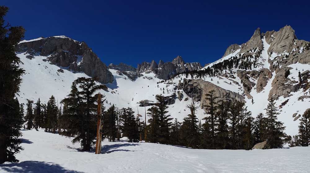
View from lower Boy Scout
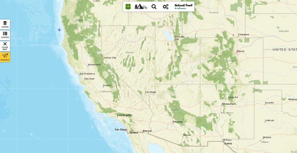
Mt Whitney sits on the Sierra Crest at the eastern most end of Sequoia National Park. An impressive looking mountain, it can be seen from most high peaks in the Sierra Nevada if you know where to look. California contains over 24 million acres of National Forest and over 6 million acres of National Park. The Sierra Nevada takes up a massive 40% of this land and contains 3 national parks: Sequoia, Kings Canyon, and Yosemite. This land provides ample opportunities for recreation from hiking, rock climbing, fishing, and of course, mountaineering.
The gateway into the Whitney region, Lone Pine CA, is only 4 hours from our outdoor education home in Big Bear.
A great resource: https://www.fs.fed.us/ivm/
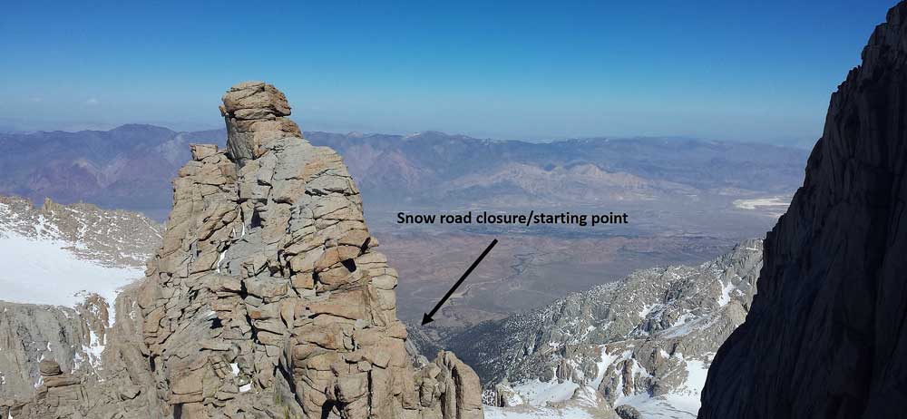
When climbing Whitney between November to June (depending on snow conditions) an ice axe and crampons are definitely necessary. The local gear shop, Elevations, is run by a fellow by the name of Jon who holds outdoor educators in high regard and is known to provide great hookups for those in need of supplies. Take the Whitney Portal Road west from town towards the towering mountains rising 8000 feet from the Owen’s Valley. When snow conditions exist, the road will be closed at around 6500 feet. Park the car here and begin the ascent. From here to the summit, the route climbs 8000 feet over 8 miles. In summertime, ambitious parties can complete the climb in one day, but given the snow we chose to do it in two nights.
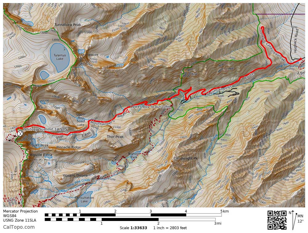
The Route!
After having left the gear shop and obtaining a permit from the ranger station, we were able to slog from the road closure up the road 3.66 miles to the North Fork Trailhead. At 0.8 miles, just before the trail crosses a second creek, leave the trail and head up an unmaintained way trail west (the North Fork trail curves to the south here). At this point we found consistent snow as we waded our way through thick willows, weaving around the snow buried creek. Once out of the trees, the trail became open enough to pop the skis on and begin skinning up the slope. We switch-backed across the snow for 1 mile, our packs weighing close to 80 lbs to finally find ourselves at Lower Boy Scout lake (10,300′) at which we would make our base camp. At this point in the season, it was also the last point of unfrozen water making it an ideal place to camp.
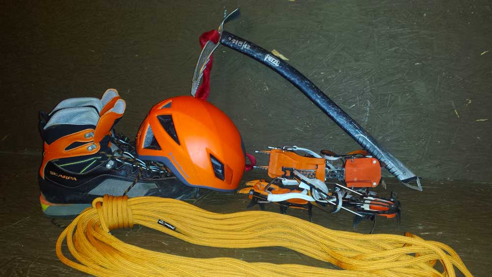
Necessary Gear…
The next day we had over 4000 feet to climb in 2.4 miles to the summit. We awoke to a beautiful Sierra blue sky and the chirping of mountain chickadees and dark eyed juncos. After skinning the morning away, we slowly but surely found ourselves at Iceberg Lake (12,600′) for lunch. Had the map not told us it was a lake, we would have had no idea this snowy landscape held water in summer.
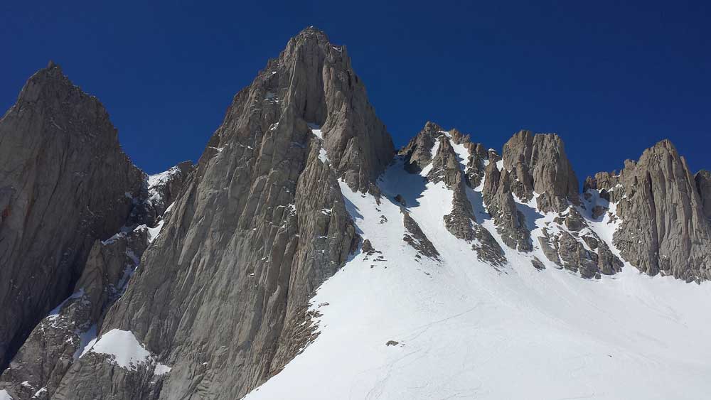
The Couloir from Iceberg Lake
As we ate, we looked up the couloir (a French word for a steep mountain gully) rising almost 2000′ above us and saw a party of four slowly making their way down. Not wanting to climb up in their fall line, we waited until they had safely descended before donning our crampons. Leaving our skis behind, we began the slog up. Periodically huge gusts of wind would hammer down from above, making us grateful for the gear holding us on the mountain.
You can see all the way back to the beginning…
After what felt like an eternity, Iceberg Lake slowly dropped behind us and we found ourselves at the notch on the ridge. With 500 feet to go, we traversed around a narrow “chicken ledge” and decided to rope up. Simultaneously climbing at the same pace to keep the rope from having too much slack, we continued up. Looking behind us, an un-arrested fall would send us tumbling down past the ledge into empty air. The slope climbed to 50 degrees with the snow and the winds ripped down from the summit.
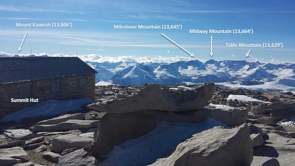
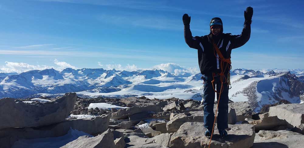
The Summit.
Adrenaline pumping through our veins, we reached over the lip of the chute to find ourselves on the summit plateau. To the east, the ground dropped away to the Owens Valley to climb back up into the White Mountains on the other side of the valley. In every other direction, the Sierra was covered in so much snow that mountains normally familiar due to their unique shape were unmistakable.
After taking some pictures, we decided it was time to depart from the windy snowy peak. After a meticulous descent, we finally reached our skis at Iceberg Lake just as the sun set. Under twilight and as stars appeared, we shredded down the rest of the way to our camp at Lower Boy Scout. Despite being one of the more popular mountain climbs in the Sierra, it is still humbling and thrilling, especially as a winter ascent. It was a good weekend…
 At High Trails Outdoor Science School, we literally force our instructors to write about elementary outdoor education, teaching outside, learning outside, our dirty classroom (the forest…gosh), environmental science, outdoor science, and all other tree hugging student and kid loving things that keep us engaged, passionate, driven, loving our job, digging our life, and spreading the word to anyone whose attention we can hold for long enough to actually make it through reading this entire sentence. Whew…. www.dirtyclassroom.com
Comments are closed.