On their very first hike here, I ask students to describe where they are, big picture to little picture.
Their answers generally start with the universe or solar system and work their way towards Angelus Oaks, Big Bear, or High Trails. It is exciting to see how interested they become in figuring out how many different ways they can describe where they are.
As with different ways to describe location, there are also different ways to navigate places. Three main types of navigation are celestial, GPS, and map and compass. In order to better understand why we teach map and compass at High Trails, it is helpful to learn the basics of all three techniques.
Celestial Navigation
Celestial navigation “is the art and science of navigating by the stars, sun, moon, and planets, and is one of the oldest human arts.” 1 Reasons abound for learning celestial navigation, such as for use as a backup to modern technology or just for fun. The general concept is similar to triangulation, where you would use two celestial bodies and an instrument called a sextant.
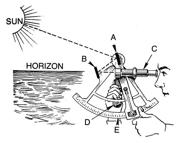
A sextant measures the angle of the body above the horizon. Adjusting for your height above sea level and using charts arranged by time, a location line can be determined. By repeating this process with a second body, two lines are drawn and their intersection should be your location. This technique is most common with sea travel, where there are often no landmarks to use.
If anyone reading this is looking out their window at a cloudy sky (I currently am), you may see some problems with this type of navigation. If you cannot see any celestial bodies, navigation this way becomes impossible.
GPS
GPS (global positioning system), on the other hand, “provides users with positioning, navigation, and timing (PNT) services”, land or sea. 2 There are three parts to this system: the space segment, the control segment, and the user segment.
 The U.S. Air Force is in charge of the space segment, which involves maintaining over 30 satellites that orbit the Earth twice a day. These satellite orbits are arranged to maximize radio signal to users in as wide a range as possible. The control segment consists of a master control station, monitor stations, and ground antennas. These help monitor and transmit signals between satellites and users. The users are you and me!
GPS technology is in our cell phones, cars, and watches; it is also used for farming, construction, surveying, and more. Mlitary applications are extensive, as well as its use in weather forecasting.
GPS is not infallible: batteries can die, service can be spotty, and sometimes they just don’t lead you where you want to go! It also seems that “using a GPS for just a few hours seems to impair people’s navigational skills in the short term.” 3 We are not teaching technology, we are broadening students’ awareness of their outdoor surroundings.
Orienteering
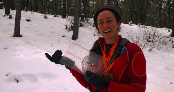
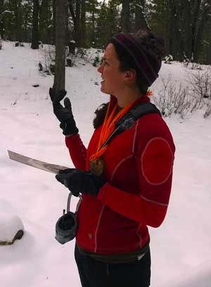
Lastly, there is “old fashioned” orienteering. Orienteering is finding your way through a defined course with checkpoints, using only a map and compass. There are official teams and competitions where people are challenged to navigate through a course the fastest. Using a map and compass, one can navigate through any area. The map provides a picture of the area you are in; the compass tells direction.
Our Orienteering Class begins with looking at a map of Southern California and having students locate where they are now and where they are from. This allows for a top-down view of where exactly they are in relation to something they are familiar with: home.
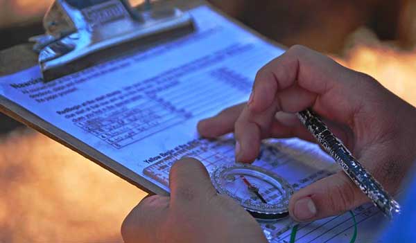
After this, it is time to introduce the compass. Every student must point to each part of the compass as it is explained: base plate, direction of travel arrow, dial, etc. Lastly, students are taught how to take a given direction in degrees, “plug” it into their compass, turn, and follow that direction.
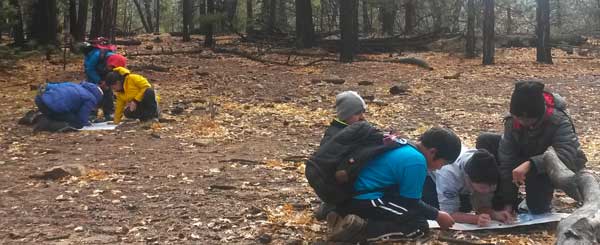
Now it is time for them to begin orienteering on our course in the woods. In teams, they must navigate properly in order to spell out different words or phrases relating to topics they have covered during their week at High Trails.
In a world filled with choices, why choose to teach map and compass?
 After teaching and observing orienteering classes, several possible reasons have come to mind. For one, it gets students to start understanding where they are. They can visualize how they arrived at High Trails and they can start to tell what direction we hike in each day.
Orienteering is a part of Adventure Day, where one theme of the day is teamwork. Allowing and challenging them to work as a team to navigate puts them to the test: Can they communicate well? Can they cooperate? Can they succeed? The answer is most often yes! It also gives them the chance to struggle and possibly fail, then work with their team, ask questions, and come together to succeed in the end.
Map and compass is a good foundation to have when learning other ways of navigation. Having a broad understanding of where you are and where you want to go can help you better understand what your GPS is telling you. Knowing cardinal directions and how to read a map can also be applied to celestial navigation and locating the sun, moon, and stars. But in the end, orienteering gives students a sense of accomplishment in finding their own way.
At High Trails Outdoor Science School, we literally force our instructors to write about elementary outdoor education, teaching outside, learning outside, our dirty classroom (the forest…gosh), environmental science, outdoor science, and all other tree hugging student and kid loving things that keep us engaged, passionate, driven, loving our job, digging our life, and spreading the word to anyone whose attention we can hold for long enough to actually make it through reading this entire sentence. Whew…. www.dirtyclassroom.com
Comments are closed.